Sunday, 21 October 2018

Tuesday 16th October 2018 (updated)

Another day which to fill with memories.

I looked at another website: a rock ledge with fine overviews. Why not? And if that wasn't enough there were a few more just a few miles walk along the ridge; why not?

Well, it was a steep hike by all accounts, and that is if we found the trailhead. And you know how hard that was yesterday.

But first, Breakfast.
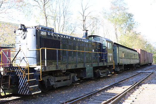
The Delaware and Ulster Rail Road, New York And then trains.

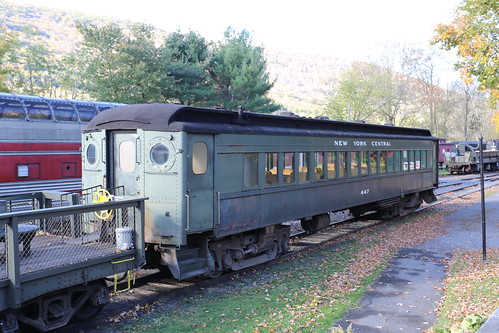
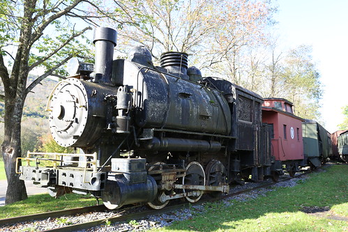
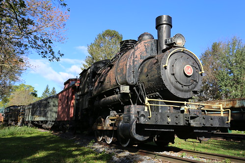
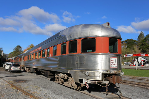
The Delaware and Ulster Rail Road, New York We went out via the rail road museum, sadly it was closed, but still being able to wander round and snap the locomotives and streamliner set was good enough. Sadly, next day it is running we will be on our way back to Boston, so, not on this trip.

Best of all they had a streamliner panoramic set of carriages. Sorry, coaches. And just see them was great. The Delaware and Ulster Rail Road, New York From the rail road museum it was a 15 minute drive to the town of Big Indian. Yes, you read that right. Along wide and sweeping rods down heavily forested valleys, over bridges that leapt over shallow rivers.
The Delaware and Ulster Rail Road, New York The directions I had for the trail head was great, other than it was on the wrong road. We go up a road, via a diversion, but it was clear it wasn't the right one. Even if driving under red and golden leaved trees beside the babbling river was quite pleasant.

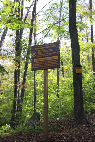
So, after driving round for half an hour, I see the signs for the trail on the main road, so we follow the sign up a long and twisting road to a hairpin bend, where opposite the trail started.
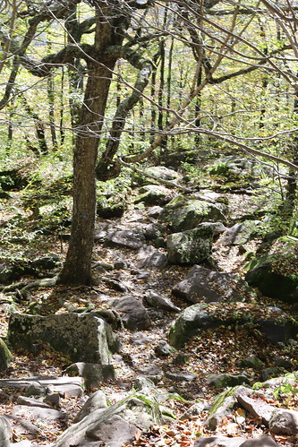
The Delaware and Ulster Rail Road, New York The path started easily. At first. And then it began to kick up. Most of the marked trail was through boulder fields, boulders between trees, it was hard going. And at the top, you went round a tree or large boulder and there was more boulders to walk through. The website had called this a "scramble". Which is what it was. Although it felt like we were crawling sometimes.

The path was at an angle of about 45 degrees, and went round and over boulders, streams and via rock cut steps. A hike to Giant's Ledge All around were trees with leaves of green, gold and a few red, sunlight shone through the leaves, and we were getting hot despite it being a very cool morning. It would have been pleasant for a walk on the level, but we were huffing and puffing well.
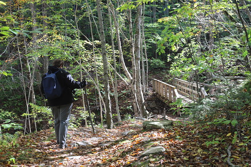
A hike to Giant's Ledge We stopped at regular intervals, catching our breath, while other fitter and younger hikers powered past us. But we carried on.
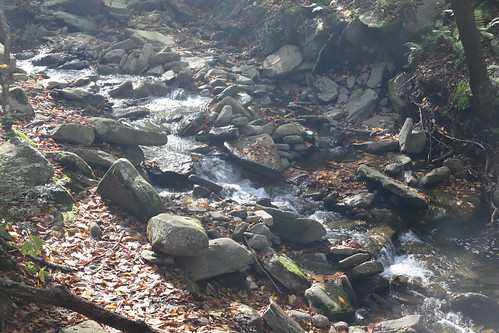
A hike to Giant's Ledge After 0.7 of a mile, although it seemed further, we reached the junction of trails, and from now on the going was going to get really though. It said point seven of a mile, felt like many times that, and I really didn't trust the directions on those bloody signs. Anyway. Onwards.
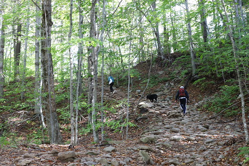
A hike to Giant's Ledge For a while the path lead over flattened boulders and slabs through a bog, a few climbs between, but just as we thought there could not be much more, the trail really took off and up.
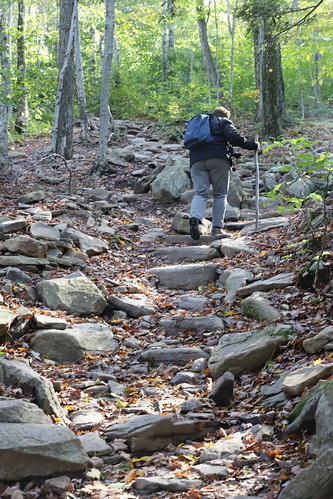
A hike to Giant's Ledge The guide book called this a scramble. That defined it, an angle of 45 degrees, through boulders and up gullies, it never seemed to end. We could see people at the top, so we knew we had to get up there, I mean we felt so close, we couldn't give up now, could we?
A hike to Giant's Ledge People who had passed us going up, now passed us as they went down. Is it far to go, we asked? Nearly there we were told, just one last scramble and then it flattens out.

Sigh.

So, up we went, if we carried on we would touch the sky!

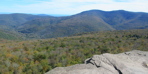
But it did level out, and through another bog and there to the right we saw clear blue sky. A woman sat with her dog admiring the view from the ledge. She left us, and we took her place, like looking out from an eyrie on nothing but trees and mountains, and nothing made by man could be seen or heard.
Two hundred and eighty eight We had this place of peace to ourselves, for a while.

But we had to be get going. Back down. And down.

It took two hours, hurt our knees as did our legs, but we did it, in two hours, all the way down until we could hear the stream tumbling down the gulley near to the car park. We had done it, were tired and hungry. But were not letting being old or fat restrict us.

We passed other just starting out, at two in the afternoon or later, with not enough time to do the climb in the remaining daylight, or so we thought. We climbed into the car, and I took us back to the main road, back along the valley road we had travelled the previous day to Hunter, and then onto Prattsville to the diner, where we feasted on burger, fries and Coke. We had earned it.

We got back to the hotel at half five, just as the last rays of the afternoon sun left the top of the tallest mountain top.

Phew.

I watch more baseball, we eat snack food and drink beer, or cider. And so the evening fades, and our poor legs and knees complain of the pounding we had given them the previous two days.

Monday 15th October 2018 (updated)

I woke from the best night’s sleep I have had on this side of the pond this trip. I guess ten days of flu, allergies and the other things had left me thoroughly pooped out. But nine hour’s sleep soon sorted that out.

Jools got up to make a pot of coffee, made from a coffee bag. Not quite as bad as it sounds, but close. No worries as in the lobby there are two pots of coffee, syrups, milk along with a continental breakfast bar, all included. So we will our boots. Or pockets.

I had searched the interwebs for things to do, and with a list at hand, we decided to go out to find something fall-y to look at and snap. Only problem was, as we were to find out, that the directions given on the sites was very, very poor.

It was a cold grey day, and the wooded mountain tops only just visible. We drove south and soon were running beside a railway. Always excites the little boy in me. The track followed the road, and us when we turned east, and on the main road there was a depot and station, all full with classic America traction. I would investigate this place another day.

Off the main road, we took a side road up a narrow gorge/valley, the rain was still falling, but it did look like it might clear up later. We were looking for a trailhead leading to a waterfall, all I knew was that it was in the area of Hunter, NY. It gave a road and directions, but was so wrong it was laughable.

We took each road out of town and saw nothing that looked like it might be waterfall. The road, however twisted and turned like a twisty turny thing, and was fnd to drive up, up and dover dips, round hairpin bends, and in a steady rain that made the road slick.

We found a trailhead, but not the trailhead we were looking for. It went through a brick arch, which seemed over the top, but with the rain falling still and light poor, we decide not to walk it.

At the top of the valley, we follow the sat nav to where the website said the trail would be, but we just ended up in a dead end street surrounded by wooden cabins.

We went back into Hunter, called in at a bagel shop for some food and coffee. And to ask for directions.

And they came through and were so helpful, telling us we had to go to the next town, and beyond to Haines Falls, then take a left until you see a telegraph pole in the middle of the road. Turn right there, and down to the end of the track.

Which is what we did, and found the parking area, and the trailhead.

We park up, grab carious cameras and lenses, and walk to the trail, at first it was easy, until we came to a fork in the path.

Now, there was a choice; an easy path to an overlook, or a difficult track to the lower falls viewing point. Guess what we chose?

We turned off from the track to the viewing platform, took a downhill track, crossed over a bridge, and from there the path began to drop down. At first through woods, but then down the enge of the gorge. And of course, with each step down, we would have to climb back up.

At times the track was steep and treacherous, sometimes easier, but no views of the waterfall to our right, just the noise of it roaring. I say roaring, not so much a Niagara more a Bridal Falls, but hey.

Two hundred and eighty seven The path twists and turned it’s way down the gorge until there was a fork, a set of steps cut into the rock lead down, and another path lead on. We would do both, but for now, we go on.

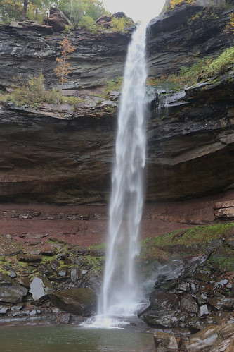
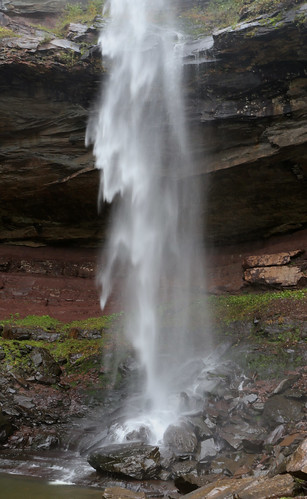
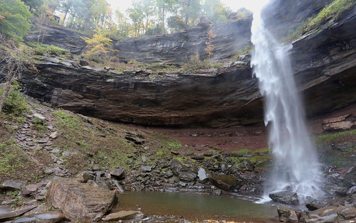
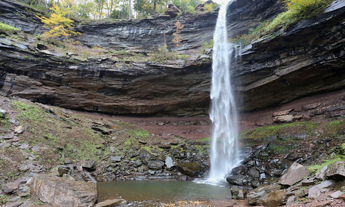
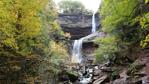
Kaaterskill Falls, New York What revealed itself to us, was a rock amphitheatre a hundred-foot height, and from one part, a waterfall maybe two metres wide fell in sheets. Just glorious. And being out of season, there was just a few folks there, and most photographers who were respectful.

Kaaterskill Falls, New York Down the stone steps to the lower fall view, and from the shelf above, a second fall added to the drop. Sure it won’t impress many, but to be there on a fall afternoon, the rain cleared up, and Jools and I had the place to ourselves. There was nothing better.

We pause for then minutes or so, to take in the scene and to prepare ourselves for what was to come.

Kaaterskill Falls, New York All there was now was the walk back.

So, deep breath, and up we go. We didn’t break any records, but we made steady progress, stopping at regular intervals for a breather and admire the view. So stopping, we see moss, fungi and lots of fallen leaves of course. Round and round, up and up until we got to the bridge, and to complete the set, I walked to the overview just to see the upper falls from above.

Kaaterskill Falls, New York We were all hot and bothered, but did it, more than most who visit here.

Back into the car, we drive back along the main road to Prattsville where we stop at the diner. A regular recommended the American Goulash, but having once been married to a Yugoslav, I know goulash. I order the American goulash, which was dry bolognese sauce with macaroni, and bland. I suppose I could have asked for some hot sauce, but I am happy with what was on the plate. But we felt we had earned our late lunch/early dinner, and we ate it all up before climbing in the car for the drive back to Roxbury.

Music, coffee, editing and Monday Night Football filled the evening, until it was half ten, and bed called. Outside the rain hammered down, meaning another night we would not sit on the terrace sipping mint julips.

Sunday 14th October 2018 (updated)

Time to leave Boston.

All good things come to an end, and so it is with this trip, as we now have to go to our third and final stop on the trip, a four hour drive away in upstate New York. I say third and final, as I was writing this as we went, as it turned out there was to be a forth stop, in the Adirondacks. But, anyway.

My boss gave me the tip of a boutique hotel in the Catskills, and being a place I had not been to before, why not?

I slept poorly thanks to a cough but must have had enough sleep. We pack, shower and dress, all ready to leave at nine in the morning, getting our car from the underground car park on the other side of the road.

The main problem was how to get out of the city. This was made all the more difficult by the sat nav deciding, on its own, to go offline. And not come back on. It would not show us the way we had to dive, but would simulate it. It took some time to realise that the map that was scrolling was not what we were seeing, but a video of the route it thought we could take.

I kid you not.

Jools had writing some directions down, and we did find our way out on to the interstate. Or “An” interstate. Not the right one, one that took us to Quincy, but would lead us south again to Rhode Island. The city looked the same, but not the same as the day before as I had not seen Fenway Park, but I knew once we reached I95 we could go north. Then west.

Only when you don’t have a map, but you’re 99% certain you’re going the right way, you do begin to have doubts. Turns out that most bits of Massachusetts looks the same as any other; who knew?

We did come to I95, turned north for New Hampshire, hoping that we could turn west along the turnpike. Even when we did we still had doubts, all indications were that we were on the right track, but the sat nav still would not work and was still labouring under the illusions that we were still in Boston.

We find a place for breakfast. I say breakfast, it was a place that seemed only to do grilled cheese sandwiches. I kid you not. Comfort food it said. Well, the one girl serving did the best she could, but the other one in a Patriots bobble had just stared at her mobile phone the whole time we were there. I mean, grilled cheese sandwich, how that ever be described as gourmet comfort food? I mean it was OK, but you know, roasted bread and melted cheese.

Whilst Jools went to buy a map. Two maps, I learned how to reset the sat nav, and when it came back online it was fine. Knew where we were, where we wanted to go. Obviously had its own ideas of the route and all, but better than before when we were only guessing.

We drove on towards Albany in New York, over the border, but failed to pick up a turnpike ticket, which would prove to be a problem later. In Mass, all turnpikes are electronic, we had a transponder in the car, they’d all be the same, no? Seems to have to to actually pull the transponder out of the holder it was in, otherwise it could not be read; who knew?

No?

Once we tried to turn off, the lady asked where our ticket was: what ticket?

I should charge you fifteen bucks if you don’t have a ticket, but thanks to our seductive English accents, she let us off with a two and a half bucks. When we said we had come from Boston it wasn't really an issue, and there we were, silly hicks from the sticks in the old country.

We drove on.

The Catskills, New York We were off the interstates and turnpikes now, driving through rich green farmland, small villages with clapboard churches, while in the distance the hills rose in a dark blue haze; that was where we were heading. I suppose I could have stopped to take shots, but the joining instructions for the hotel made it sound like we were staying in some American Brigadoon, as the sat navs always take you wrong. Adnd with what had happened earlier, we had a very low regard for the sat nav as it was.

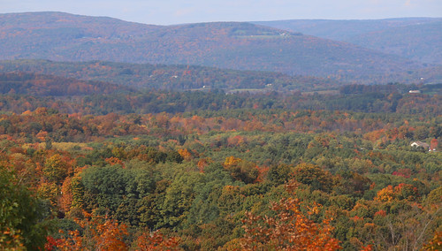
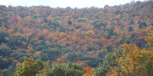
The Catskills, New York After an hour, the road began to climb and climb. There is a viewing point, overlooking the countryside and woodlands below. We stop to take shots of the golden and read leaved trees. It was very nice, and as it turned out, the best view of foliage we would see until we left New York for Vermont at the end of the week, but we did not know that, we still thought fiery foliage was everywhere.

And we drove on.

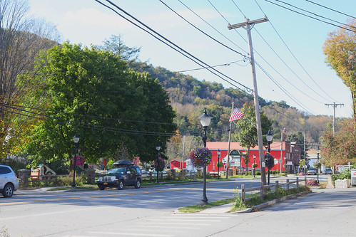
Prattsville, New York Up and over the mountain, and a long slow descent into the wonderfully named Prattsville. We needed a drink, and in truth we needed to find a laundromat. And it had one, so we took the suitcase of stinking clothes, pumped the machine with quarters and then we had an hour wait in which we did some shopping, as the hotel, motel, we were staying at, was remote and to be honest, we did not want to go out for dinner. So we got frozen pizza. And beers. And cider. And wine. And Boston beans.

I talked long to the guy who ran the wine shop. He sold no beer as he could not compete with the market opposite, but did some good Italian wines at a reasonable price.

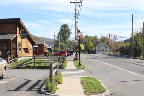
Prattsville, New York It was a half hour run into Roxbury, where at the far side of the town is our base for the rest of the week.

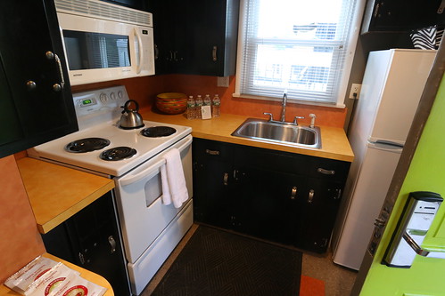
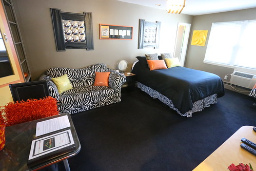
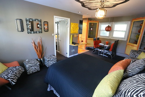
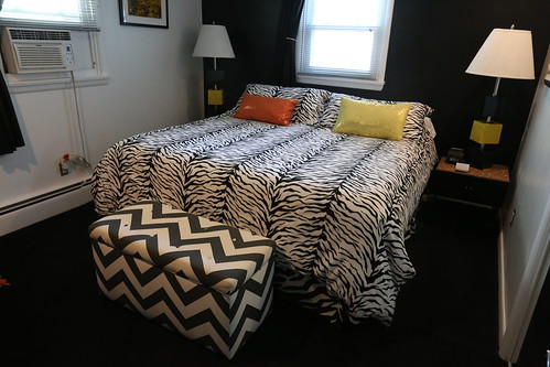
Two hundred and eighty six We check in and were shown to our 70s themed room. Suite.

The shagadelic pad, The Roxbury I suddenly realise that we have been on the go since we left home, and all I want to do is relax. Plan nothing.

The shagadelic pad, The Roxbury Which is the plan.

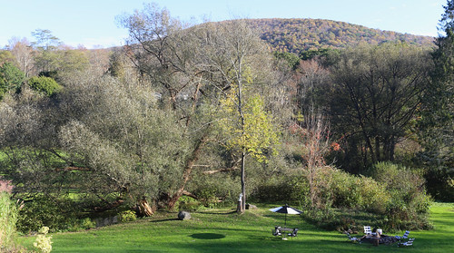
The shagadelic pad, The Roxbury We have a beer sitting on the sundeck outside watching the wildlife; blue jays, birds of prey circling, and another monarch came fluttering by. It was so wonderfully warm, and I thought it was going to be like that all week. Had we known snow and chilly weather was coming, we would have made better use of the warm weather, but as it was, we drained our beers and went inside to listen to some radio/

The shagadelic pad, The Roxbury For dinner we have frozen pizza, which after 20 minutes is no longer frozen, but hot and tasty. Saves going out to find somewhere to eat. I suppose I should say that Roxbury is a small town, and the only nearby restaurant is currently closed. We had done enough driving, so had a quit night in, writing, editing photos and watching more baseball. Though I only make it to the bottom of the 7th, with Red Sox on top, 6-4.

Saturday, 20 October 2018

Saturday 13th October 2018 (update)

And the final part of our trip hoves into view, as we had to collect the hire car which will enable us to get to our final hotel, in Upstate New York.

We had encountered trouble in picking up the car in the city and dropping it off at the airport, the website kept crashing, so just to get the agreement done, we had to pick the car up at the airport.

We just had to decide how to get there.

Boston is a very different city from New York, smaller, less busy, and the airport is just over the water from Downtown. Driving there is now easy thanks to the completed Big Dig, and there is a metro, and from the station nearest to the hotel is just three stops down the line. I had favoured a taxi, but riding on a new subway? What's not to like?

Once we were up and about, we got dressed and were out of the hotel at nine, and like the City of London at weekends, all the shops and cafes around here are closed at the weekend, so we think we would have breakfast at the airport. So we walked uptown from downtown, as is the way and tried not to hear Pet Clark singing as we walked.

The metro station entrance is built into the old State Building, which is an odd way of catching a train, but once down the stairs, a helpful member of staff said we could buy a ticket for two people for five bucks, showed us how the machine worked, and told us which platform to go down to.

Catch a train for Wonderland he said.

And so Big Country played in my head. But then I was taking my wife to Wonderland!

We waited on the platform until a modern train pulled in; being early in the morning it was just about empty. We stood as the train dived under the river, passed through two stations before depositing us at the airport. All we had to do was work out how to get to the terminal!

But the metro station is not in the terminal, we had to catch a bus.

A bus was waiting, and I insist we sit on the back seat like all bad boys do. Soon it took us on a three minute ride to the rental car building passing some major intersections and roads to other terminals, not the the arrivals terminal, so no breakfast again.

We get the car with little fuss, a Toyota thing, quite large, but no Mustang. It would prove to be slighly annoying, as the slightest pressure on the accelorator would cause it to drop a gear or two, so never seemed to be in a settled state, unless cannoning down the interstate at 70.

Jools said “should she program the sat nav”? No, I know where I’m going. Fateful words.

The roads out of the airport are all different now the Big Dig is completed, and I saw no signs for the north coast, New Hampshire or Maine. Instead we go through a series of tunnels, out the other side past Fenway park and out through the suburbs. Running beside a commuter line, which meant my concentration was on that rather than the road signs, so it wasn't going to end well.

We pass under I95, but there were no signs for north either, just south to Rhode Island. But we knew we had missed the turning. It was pleasant enough, but we were heading in the wrong direction; west.

A few miles on we stop at a rest stop, go into a Dunkin Donuts for breakfast of bagels and sweet coffee, then back outside to the car to program the sat nav.

Which then proceeded to take us back into Boston, back to almost into the centre of the city before turning north. Didn’t feel right to me, so we drive through leafy suburbs, downtrodden areas and industrial zones, all while the rain grew steadier and steadier. It was all interesting, but not that picturesque, and had I not been to Rockport before, I would have thought it not worth bothering with.

Two hundred and eighty five But we were heading north, just not very quickly. We go round what was called roundabouts, but were just huge junctions, with traffic lights, and no lanes and poor signs pointing the ways off. I was tense. But we kept on the right roads, the city thinned out, and we carried driving on lanes and four lane highways.
After an hour we came to Salem.

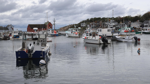
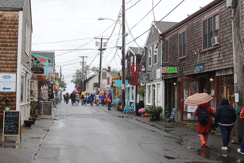
Bearskin Neck, Rockport, Massachusetts Salem is spooky central, and with it being Halloween this month, and elsewhere in America this is a month long event now, you can only imagine how serious Salem takes it. Traffic was nose to tail along the main road through the town, and crowds of people filed out of the car parks on the edge of town walking to where the action apparently was. It was Saturday I suppose, but the thought of going there when the crowds would be thick wasn't a good one.
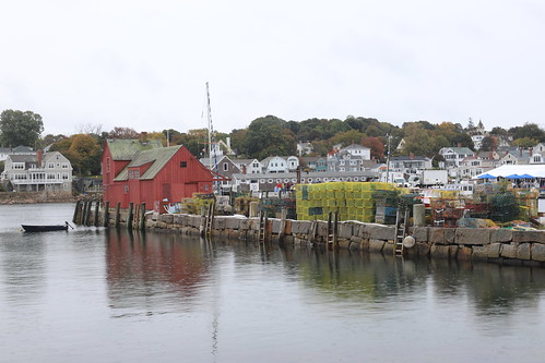
Bearskin Neck, Rockport, Massachusetts Once through Salem however, the urban sprawl of Boston gave way to New England rural country, so the road wound its way through pretty villages made of clapboard houses, white clapboard churches, it really was very pleasant. The road crossed and recrossed the commuter line from Boston to Rockport, one which I have travelled on a few times, but we saw no trains. The villages mostly had names from back home, so it was interesting to see how closely they resembled those places in England: not very.

And from time to time, the road came back to the coast so glimpses of panoramas along the coast could be seen, just no where to park though. As most along the coast, shoreline seems to be private property, or where it wasn't, the rain fell heavily.

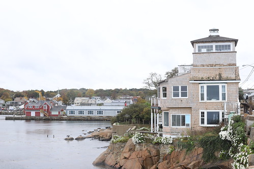
Bearskin Neck, Rockport, Massachusetts We went through Gloucester, the town before Rockport. This I knew as back in the day, or 15 years ago, Rockport was a dry town, and I had to get a cab into Gloucester to find a bar to watch the baseball on whilst drinking a beer. You could go whalewatching from here too, and I had as well, back in 2005, on a wonderfully hot day when the sea was like a millpond, and we saw half a dozen species, but film was so expensive, I took only a handful of shots. We drove on. Where there was a market on, the main road through the town closed, and all parking taken.

We drive round and find a place on a side street, as being British we don’t mind a walk. We amble back towards the centre of town, past four churches on one street until we came to the market, and the shops beyond.

All things change, of course. Even small towns like Rockport. Shops I remembered being there had been replaced by others, the restaurant I snapped the harbour from is now a clothes shop, the chowder shops have all but closed, just two remain.

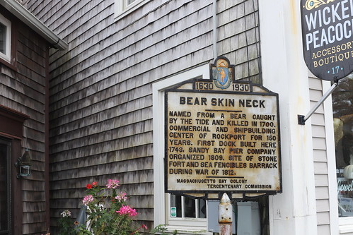
Bearskin Neck, Rockport, Massachusetts But the town is thriving, lots of visitors, ice cream shops and coffee shops. The town also has the best named street ever; Bear Skin Neck, which is on a headland and leads to the breakwater, and was once lined with fishermen’s cottages, but is now shops. And more shops

We walk to the end, walk back, and having come all this way we were not leaving until we had some clam chowder. So, we go into a restaurant at the bottom of Bear Skin, order two bowls of chowder and beer and cider. It took me some time to realise that booze was on sale in the town now, as when I was here, the city ordinance had banned it for over a century.

All things change.

We have huge ice creams, in waffle cones, way too big, really. But were good, and I ate all my salted caramel and pretzel flavour!

I had wanted to continue north into New Hampshire and Maine, but a check on the sat nav showed York Beach to be 90 minutes away, a three hour return trip, and then we had to get back into the city. It was half three already, there didn’t seem time.

So, Jools programmed the way back to the hotel, and we set off south.

But the sat nav seemed to have a thing about going on main roads, and soon told us to turn off route 128, down by the power lines. We ended up driving by the Stop n Shop, I liked that better than walking by the Stop n Shop. It took us through more picturesque villages until we arrived back at Salem. Not as busy at half four in the afternoon, we get through OK and are back into Boston.

I can’t describe the sheer panic of driving back into the city, coming to intersections where I had no idea if I should give way or the others would. Worse case was a five way junction: I mean there were lines on the road, but no traffic lights, I was just lucky nothing was coming the other way. I dashed across hoping I would not splatter someone on the way over the road.

Down wide roads, through urban areas with huge trucks double parked almost blocking the way, down sidestreets, over bridges until we suddenly come to the financial district, there is the park with the entrance to the underground car park; we had made it!

We go back to the hotel for a bit before going out for dinner at one of the pubs along the road. But where on Friday the places were heaving, on a Saturday, it was so quiet, we had to ask if they were doing food. They were.

So we have nachos to share, a cocktail then a main course, but with only one other couple eating, the food came quick and was excellent.

Back to the hotel to watch the baseball, I was determined to watch it all, but at quarter past eleven, at the bottom of the 7th, I was done.

Another day gone, and tomorrow, a road trip.

Friday 12th October 2018 (updated)

Autumn comes quickly. As soon as the sun stopped shining and the clouds rolled in, the temperature dropped, the wind blew, and it was chilly. But should clear in the afternoon, but once out on the streets with the rain falling steadily, it seemed doubtful to be honest.

Again, we decided not to eat in the hotel, so into the rain and uptown we went. We went to find a place to have breakfast, and ended up at a bagel place opposite the Irish famine memorial; bagel, juice and coffee while we sit and watch the rain run in small rivers down the street outside, and the traffic line up at the traffic lights. There were all sorts n, avoiding the weather; people in suits, people with their belongings in a couple of large bags, all nursing a coffee.

Grim.

For the day we had planned a whale watching trip, I had booked online the afternoon before, so all we had to do was get us to the pier before departure time. With the internet this was easy enough, we walked back down towards the river and the piers.

And was cold.

I had on my rain jacket, which I hate as it doesn’t allow the body to breath, so slowly cook in it, so am nearly as wet with on it as without it. But we would need jackets out at seas for sure.

We walk down to Quincy Market again, but it is only opening up, with only a few people about. Shops are also just opening, and we are among a few braving the weather. We cross the main road to the docks, and begin to look for where we needed to be, even if there was an hour to go.

We walk to the aquarium, and look at the seal play whilst their keepers try to fish seal poo out of their tank. Its a living. The harbour is grey, and the sky has the promise of rain. The breeze blowing would make it an interesting sailing, for sure.

We find the pier, find the both that it was still selling tickets meaning the trip was going ahead, we ask for details and were told to go to gate 4 along the pier, which we do, and when we get there we find hundreds of people already waiting, so we join the back of the line and wait. More people join behind us, so by the time comes to board, I guess there was nearly five hundred of us waiting.

Jools and I go out on the back deck, thinking we would “bags” a good spot to watch the whales from when we get there.

It was cool enough waiting at the dock, but once we pulled out and were cruising along the river, it got cooler. Then when the engines were opened up fully, and we headed out to see, staying by the railings was impossible as waves of spray came crashing over and would have soaked us. And was downright cold. I had a seat in the middle of the back row of seats, just in range as the soacked stars and strips flag, glown about by the breeze and movement of the boat, swung round and slapped me in the face. Time and time again. How did a flag know I was a redcoat?

We took shelter in the lea of the cabin and sat there was the boat powered northwards along the coast, leaving the skyscrapers of Boston behind. They got smaller and smaller, until after an hour they were all showing above the horizon twenty miles or so away.

The engines were killed, and the boat slowed to a stop, people, and us, rushed to the railings, and began scouring the waves for signs of whales.

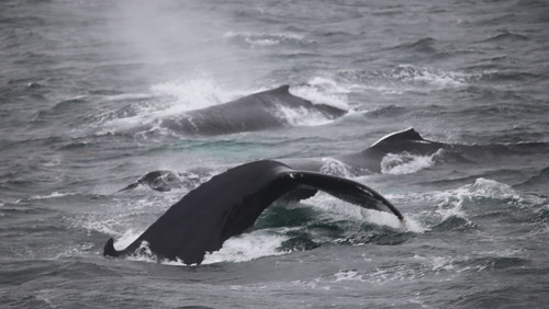
Two hundred and eighty four I saw the first ones, just a hundred yards off the port bow, lazily breaking the water and slowly going back under water. They did this once, twice three times before they all dived. This happened a few times, we saw others in the distance, breaching, creating huge splashes.

We got close to another family group, and behind there was another breach with huge splash. It is impossible to know where a whale will surface, you just have to be quick with the camera, so all I got was white water from the splash.

On the town in Boston The captain announced he had been advised it was too dangerous to stay out being close to the whales, so he said we had to turn for home. He opened up the engines and we turned for Boston.

Above us the clouds cleared so by the time we were back in Boston it was a bright day and was warming up again. As we walked out through the main cabin, there was the smell of stale vomit from those that did not enjoy the trip as us. But we took shelter in the lage cabin below, just to try to keep warm, and others tried to keep their minds of the movement of the boat as we skipped from wave to wave back to Boston.

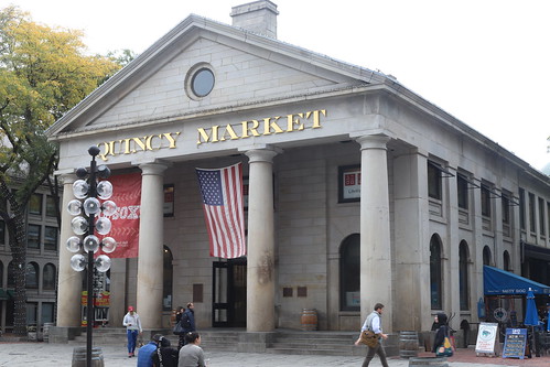
On the town in Boston Back on land we go to Quincy Market which was nearby, and find a hot dog stall, order a Boston Growler, or something, each, and go to eat it outside. I have to say, I was underwhelmed.

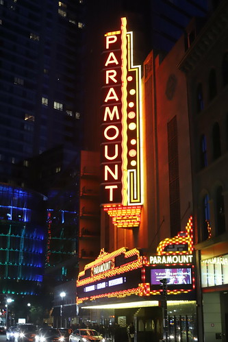
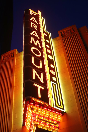
On the town in Boston We go back to the hotel to warm up some, before heading back out again just after sundown so I could snap the neon lights at the Paramount Theater.

On the town in Boston Night-time brings all the freaks and geeks onto the streets, it makes a heady mix, especially on a Friday evening with families and shoppers mixing it with skateboarders and gangbangers all hanging around, not causing trouble, find it all seems a little intimidating to say the least.

The theatre is all lit up, so I get the shots I wanted, we then walk up alongside Boston Common, which I thought would be nice. Turned out was all lined with fast food joints and jammed with more gangbangers and students. We turn for the quieter parts of uptown where there was a couple of blocks with bars and bistros on each corner.

On the town in Boston We find one which is lively, has multiple screens each tuned to a different sports channel, as is the American way. We get a table, order a beer and a bison burger, which come in double quick time. We eat, pay and are heading back to the hotel in little over half an hour, just in time to see the latest round of baseball post-season games begin. I watch that while Jools watches more Breaking Bad on the laptop until my eyes can’t keep open any more, and we call it a night at ten.

Phew.

Thursday 11th October 2018 (updated)

Boston.

As it turned out, the only full day we had in the city, so just as well we got out and about nice and early. The forecast for the day was poor, and getting worse with the possibility of lightning later, so we had better get out of the hotel and about before the bad weather hit.

We do not eat in the hotel, as the cost is not included, and the place is a 5*, so would be expensive. Instead we walk back towards Boston Common, then turn, er, right, and come to a Mexican place that looked OK. We go in and have burritos and smoothies, which was very good indeed. All was served with smiles and bothing was too much trouble. I mean I shouldnt be surprised, but the food and service was great, in what was really another fast food joint. We tip the staff well.

Walking the freedom trail in Boston And then onto the trail.

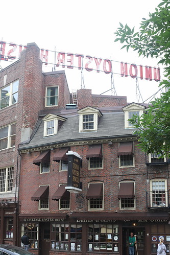
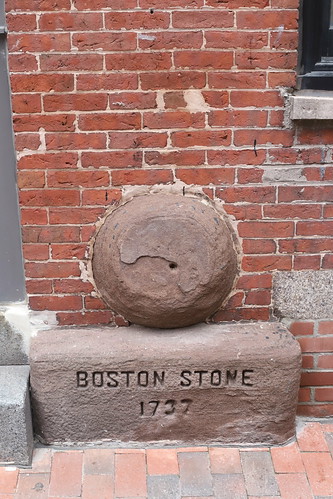
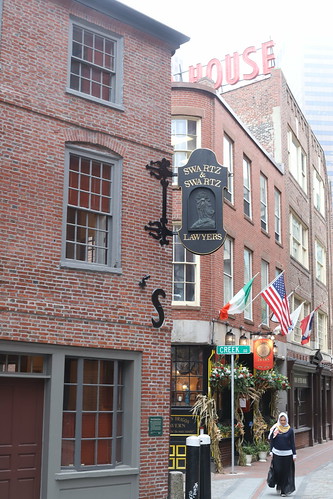
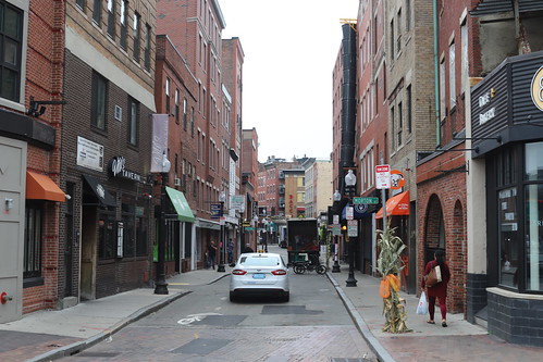
Walking the freedom trail in Boston Boston has created a red line, or in some places, two lines of bricks, taking the walking tourist on a tour of the revolutionary sites, one after the other and never getting lost. The only downside is that sometimes there are many people walking it too, but hey, you won’t get lost.

Walking the freedom trail in Boston We pick up the trail at the edge of the financial district, and head down towards the harbour walking round Quincy Market, before it crosses over the interstate which now runs underground, and into Little Italy. Apparently, this is the oldest Italian community in the US, and easy to believe, and had a very much more Italian feel than Little Italy in New York.

Walking the freedom trail in Boston The narrow streets helped, and many of them being cobbled, and with Italianate churches thrown into the mix. Most have cafes offering espresso and lattes, all look tempting.

Walking the freedom trail in Boston We stop for a coffee, pumpkin spiced latte, and was the best coffee we have had since arriving. As we sit there, people who work in other shops in the neighbourhood stop in for a coffee and a chat, all done in exciteable Italian, as it should be. We could have been in Naples, rather than Boston.

Walking the freedom trail in Boston From there, the trail goes past Paul Revere’s house, and farther up the street, the church he lit a warning of the approaching British army. Finally, there is a burial ground with stones dating back to the start of the 18th century, oddly not many people stopped to look in, but we did. I had been here before. There were, however, huge groups of people being guided along the trail. I mean, why? Could they not find their way themselves, it is just following a red line after all, and all the sites are marked and have information boards?!

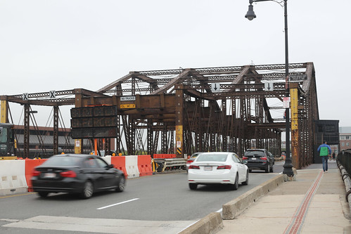
Walking the freedom trail in Boston From the burial ground, down a slope, across a major road then over the river by way of a metal bridge with the roadway and footway made by a metal mesh you could see through to the water below, we cross over with a few people also walking. A woman stops us, is this the Freedom Trail she asks pointing at the red line? Yes, just follow it and see where it leads.

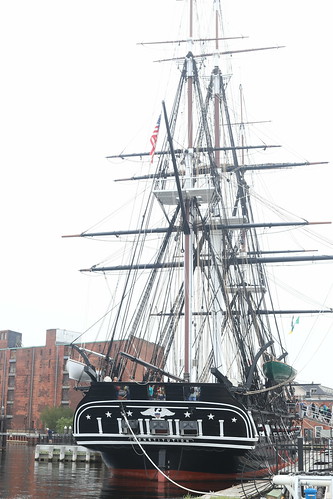
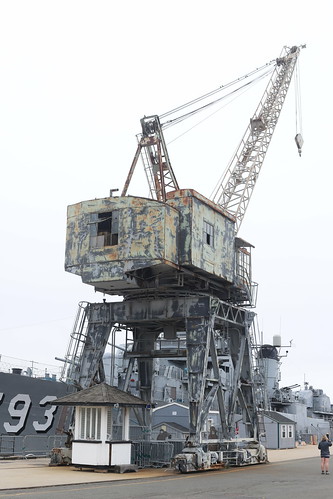
Walking the freedom trail in Boston On the other side we turn towards the old Naval shipyard, down through a new housing development, and into the old shipyard, and made of cobbled streets and open spaces, it houses a couple of ships, one the USS Constitution, which you can look up on Google. I had also been on that before, so did not pay to go on again, I just walk round the yard snapping details. We sit down to take in the details. I was still suffering from the flu and was overheating even though it was much cooler in Boston than in New York.

Walking the freedom trail in Boston There was a branch of the trail leading to Bunker Hill which is topped by a monument, again I had climbed that some 13 years ago, and I remember it being a struggle, and I did not feel like doing that again, especially as both Jools and I are recovering from bouts of colds/flu, and not feeling too sharp. We find ourselves walking with another British couple, they had arrived on a cruise ship that morning, and were doing the city in a day before their flight home that evening. We leave them as they contemplate climbing Bunker Hill monument, we turn back to the city.

We walk down through Charlestown, an old neighbourhood lined with clapboard houses painted in pastel colours.

Two hundred and eighty three It was now just after one, so we walk back to Little Italy where we find a good looking place for lunch. It won’t come as a surprise to learn we have insalata caprese followed by a pizza to share. And we splash out on a bottle of prosecco; are you celebrating anything? Just being in Boston, which they were happy enough to hear. Though, of course, this trip was to celebrate our 10th anniversary, so we toasted that.

Walking the freedom trail in Boston On the way back to the commercial district, clouds above began to darken, and within a few blocks of the hotel, it began to rain. Hard.

Walking the freedom trail in Boston As it was three, we decide to walk back to the hotel as the rain fell down harder, getting back whilst still partly dry.

Walking the freedom trail in Boston We stay in the room listening to the radio and snoozing. Some three hours pass and the rain continues as darkness falls.

Walking the freedom trail in Boston At eight we go out to look for a place to have dinner. And we find a bar a block from the hotel, they did a good line in craft beers and Guinness flavoured burgers. We were served by a waitress who came from Hawaii, who apologised for her accent. No one should ever have to apologise for that, but like most Americans, she loved our accent, and started saying “cheers” back to us instead of thanks.

And that is it, just back to the hotel to watch some NFL, and that was another day gone.